Meet the Meteorologist
What's your favorite weather phenomena?
What got you interested in the weather?

Imagine it's a late summer evening and you are enjoying the falling temperatures in your area. Then, in the blink of an eye, a sudden high wind gust occurs. Simultaneously, the air temperature has climbed from 70 degrees to over 100 degrees. Suddenly, it feels like you are in an oven. What could have caused this rapid rise in temperatures this late into the night? The answer is a heat burst.
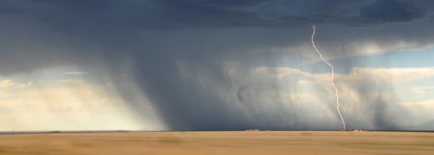
Heat bursts are a rare phenomenon, but they do occur occasionally. The portion of the country that sees them most often is along and off to the east of the Rockies in the western high Plains. In order for a heat burst to develop, a delicate recipe of atmospheric variables must align. The first needed entity is a high-based (or high-altitude) thunderstorm that is weakening and about to dissipate. Secondly, the air at the height of the thunderstorm and a layer below it must be extremely dry.
Remember that thunderstorms are always composed of a column of rising air, called an updraft, that feeds the storm and keeps it healthy. Thunderstorms also have a descending column of air, called a downdraft. As long as the downdraft doesn’t become more powerful than the updraft, the storm will usually survive.
When rain falls out of a thunderstorm, a portion of the rain evaporates before hitting the ground. In order for raindrops to evaporate, warm air is absorbed into the raindrop as it turns into water vapor (latent heat absorption). This leaves the air around the evaporated raindrop cooler, and therefore, heavier than the air around it. The cool and dense air supports the downdraft. When a thunderstorm moves into extremely dry air, the amount of rain-cooled air near the base of the thunderstorm accumulates, resulting in an accelerating downdraft that eventually reaches the ground.
When downdraft speeds of a dying storm accelerate to speeds of over 60 mph, the air becomes compressed on its speedy descent. When air is compressed, it is heated (much like how the hose on a bike pump heats when you are pumping your bike tires). This explains the 30 degree plus temperature rises that can occur in the middle of the night during a heat burst.
 Derek Heit
 Jennifer Wojcicki
 Laura Lockwood
 Ray Miller