Meet the Meteorologist
What's your favorite weather phenomena?
What got you interested in the weather?

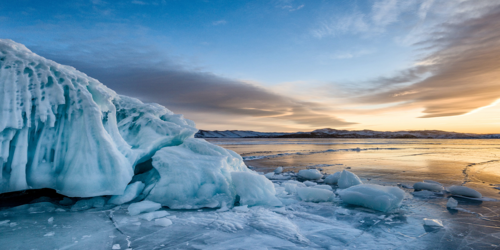
This past weekend, an historic snowstorm pummeled much of western Montana and Wyoming, as well eastern Washington State and Idaho. While extreme weather is nothing uncommon over Big Sky Country, this event broke numerous records that stood for decades. The snow event occurred from September 27th through the 29th. The heaviest totals occurred on the Lewis Range in and around Glacier National Park, located in the northwest part of the state. One of the largest snow totals was a whopping 52 inches that fell in Babb, MT. For Great Falls, MT, this snowstorm dropped 17.7 inches of snow in a 24 hour period, which is a record for any snow event. The three day event total of 19.3 inches ended up in second place all-time. Record cold temperatures in the single digits and teens occurred for many areas in the wake of the historic system, as unseasonably chilly air was reinforced by the unusually heavy early season snowpack. Let's look into how this epic autumn snowstorm came to be and when the first accumulating snows typically occur across the country.
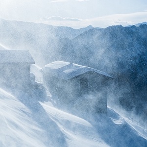
The setup for this incredible autumn snowstorm was brought on by a deep trough of low pressure that set up over western Canada last week which was reinforced by a low pressure system in Alaska, which moved southeast into the Pacific Northwest. As the low headed south, early season arctic air pushed south from the Canadian Arctic into the northwest US. As the low intensified Friday night, moist southeast to easterly winds from the Plains of the US brought extra moisture into western Montana. This resulted in heavy snow bands as the moist air rode up the slopes, in a process called orographic lifting.
Historically, the first accumulating snows across the western half of Montana occur in late August or early September over areas above 5000 ft. For areas below 3000 ft, the first snowfall typically doesn't occur until late September or early October. The timing of the recent snow event was nothing unusual, but the high amounts and the lower elevations that were hit was. Other heavy snows have occurred in late September, such as in 1934 and 1908. This storm fell short of breaking some of the records set by those events, but many others were eclipsed. The incredible aspect of it all is that, if last weekend's storm would have hit in early February, it would have still been historic!
To see when your part of the country expects its first snow of the season click here and then zoom in and click on the circle closest to you. Residents of the Plains can also utilize this graphic to see when the first flakes are expected to fly.

 Derek Heit
 Jennifer Wojcicki
 Laura Lockwood
 Ray Miller