Meet the Meteorologist
What's your favorite weather phenomena?
What got you interested in the weather?


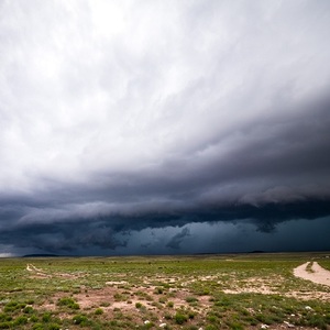
Hail is unfortunately a common occurrence for folks in the Plains of the US. When hail becomes as large as a quarter, the potential for damage increases. This is why hail that is quarter-sized in diameter or larger is considered severe. At that size, damage to roofs, cars, and crops is possible. The states of CO, NE, KS, OK, and TX see more severe hail than any others in the lower 48. Let's look into how hail forms and what makes the western Plains of the US such a haven for hail storms.
In order to understand how hail forms, a little background knowledge is helpful. In general, air temperature falls as you climb further up into the atmosphere. The average drop in temperature with height is about 3.5F for every 1000 feet you climb in elevation. Anyone who has climbed a mountain knows this firsthand, as the climb may start out at a comfortable temperature and then before you know it you are reaching for your jacket and heavier pants.
A thunderstorm, in its basic form, is composed of an updraft and a downdraft. The updraft is an upward-directed stream of air, while the downdraft is a downward-focused stream of air. As clouds grow into colder regions of the atmosphere, they become composed of ice crystals and water droplets that are colder than 32 degrees. These water droplets are called "supercooled" water droplets and serve an integral role in hail formation. When supercooled water droplets are pushed high into the cloud by the updraft, they collide with ice crystals that are suspended in the cloud. These subfreezing water droplets freeze onto the ice crystals, resulting in multiplying ice pellets. These growing hailstones will then fall to lower elevations of the cloud that are above freezing as they are swept downward by the storms downdraft. Then they can get swept back up by the storms updraft, as they return into the subfreezing portion of the cloud. This results in another cycle of supercooled droplets freezing onto the growing hailstone. Multiple layers of ice form as the hailstone increases in size with each trip. Once the hailstone becomes too heavy for the updraft to support any longer, it falls to the ground. The stronger the updraft, the greater risk there is for severe hail.
The two main contributors to making large hail are a high updraft speed and quickly cooling temperatures aloft. The colder that temperatures are aloft, the less the hailstone will melt on its trip to the ground. The table provided shows what updraft speeds are necessary to produce different sizes of hail. For hail to grow to softball size in diameter, the updraft would have to be just over 100 mph.
The provided image shows the largest diameter hailstone on record that fell in Vivian, SD on July 23rd of 2010. The hailstone was measured at a whopping 8 inches in diameter and weighed just under 2 pounds. It has been theorized that the updraft in the thunderstorm had to be around 180 mph to support a hailstone this large.
Click here to see the largest hailstone on record.
https://www.weather.gov/images/abr/EventSummaries/Thunderstorms_Tornadoes/20100723/Diameter.jpg


 Derek Heit
 Jennifer Wojcicki
 Laura Lockwood
 Ray Miller


